Apollo Bay to Cape Otway September 2025
Published:
The first third of the Great Ocean Walk covers Apollo Bay to Cape Otway. It starts in town following the Great Ocean Road for a few kilometres before following the beach for a while. Towards the end is climb up to Eliot Ridge.
The full walk goes for just over 100km. It's split into 8 sections that are 10 - 15km long. It is designed to be done one way in an east west direction. This helps manage issues like cinnamon fungus, a disease that has caused lot of damage to the area. It also works best with the prevailing weather.
Some people choose to do it over less time, but that's not me. We had limited time so we could only do part of it. So we planned to do the first 3 sections over 3 days. That gives a good variety of coastal and forest scenery.
Day 1
Apollo Bay To Eliot Ridge
The first day of the Great Ocean Walk, from Apollo Bay to Elliot Ridge Campsite, is a great little warm-up. It starts in Apollo Bay, and for the first bit, you're pretty much just following the road out of town.
You'll pass through the small hamlet of Marengo, and it's a bit of a mix of walking on the footpath and right next to the Great Ocean Road. After Marengo it turns into a proper walking track.
The walk follows the coast for a while, so you get to enjoy some beautiful beaches with the constant, powerful roar of the Southern Ocean. If you're there between May and October, keep your eyes peeled. You might just spot some whales! We were a little late for whale season, so they'd already moved on, but it's always worth a look.
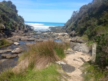
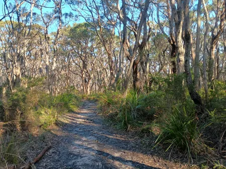
The landscape then changes. You leave the coastal views behind and head into forest. It's a totally different vibe. Surrounded by towering eucalyptus trees and ferns. The last part of the day is a steady climb up to the campsite. It's not a super long day of walking, but that final stretch can definitely get your heart pumping!
The Elliot Ridge campsite itself is tucked away among the tall trees, and you might even be lucky enough to spot some koalas. We didn't see any, but you could definitely hear them! The wind was quite strong. You could see the trees swaying, even the really big ones.
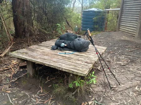
It's a great spot with a shelter, tables, and toilets. We left the first chance spot we found when I large branch came crashing down from above. Reminder to always check up and look for they scratch is that may drop.
Just a heads-up about the water from the tank, it's quite brown, but that's just tannins leaching out from the leaves on the roof. It's perfectly safe to drink and tastes fine, even if it looks a bit like light tea, even after you've filtered it.
We had the whole place to ourselves so we are able to selfishly spread out in the shelter.
Day 2
Eliot Ridge To Blanket Bay
Day two of the Great Ocean Walk is a totally different beast from day one. You leave the coast behind for a while and head into the forest. Towering gum trees reach for the sky, and the forest floor is covered in a thick carpet of ferns. You feel completely surrounded by nature here. The trail winds through the trees, and for a good chunk of the day, all you hear is the sound of the forest. It’s a nice change from the constant roar of the ocean.
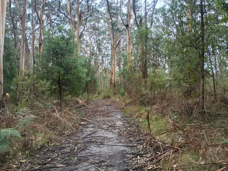
It had been raining overnight and it started to pick up in the morning. Out came the wet weather gear as we walked our way through forest tracks. They were clay which made it quite slippery. There were a few trees down along the way, lying across the track but nothing that stopped us from continuing on.
Unlike the first day, there aren't many coastal views on this stretch. We were basically just immersed in the bush, following old management tracks and walking paths. Some people might find it less exciting, but honestly, it's a quintessential Otway experience. It really makes you appreciate the inland beauty of the park.
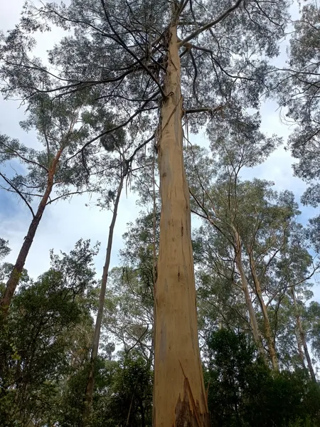
After a few hours, you'll start to feel a change in the terrain. The last part of the walk is a steady downhill slog towards the coast. The soil changed from clay to sandy. This made trying to be better and was not as slippery. It also meant the trees were smaller is sandy soils don't hold tall trees as well as clay. It’s a bit steep, so you have to watch your footing, but it's a welcome sign because you know you're getting close to the ocean again!
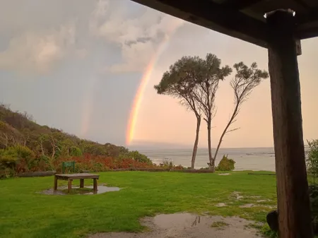
Finally, you emerge from the forest and the sight of Blanket Bay is your reward. This place is an absolute stunner, a beautiful, sheltered cove with a pristine beach. The campsite is right there, so you can drop your pack and head straight for the sand. After a long day of walking, sitting on the beach and listening to the waves crash is the perfect way to unwind.
Day 3
Blanket Bay to Cape Otway
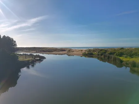
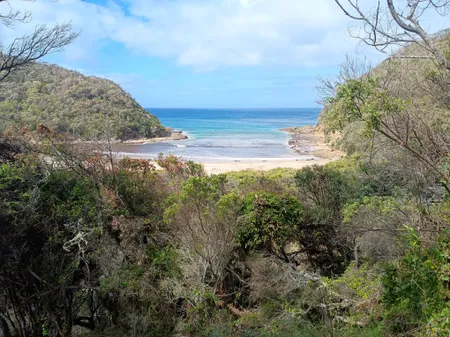
The track from Blanket Bay largely follows the coast. It goes along the cliff tops which gives you great ocean views. After following the coastline for awhile, the track heads slightly inland to cross some intermittent streams and takes us down to Parker Inlet. We crossed the first stream which involved a little bit of rock hopping and then walked along the beach for 100 metres or so to the second one. The tide was out so only came up to our knees when we waded across.
The trail out of Parker Inlet involves quite a climb. Is often referred to as the "300 steps". Takes us up to Parker Campground which was a good place to have lunch. The guide said there were picnic tables but no water but we found quite the reverse. There was quite a full tank next to the toilet block and not a single picnic table to be found. So we launched on some rocks and looked out over the ocean.
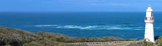
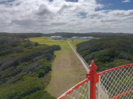
Once rested up we walked through the bush. After a while we started to catch glimpses of the Cape Otway lighthouse. The track itself is fairly gently undulating up and down. We started to get tired towards the end of the afternoon. We made it to the lighthouse area, but it was due to close in about half an hour. After a short rest, we picked up our bags and made our way for the final 500 metres to the campsite.
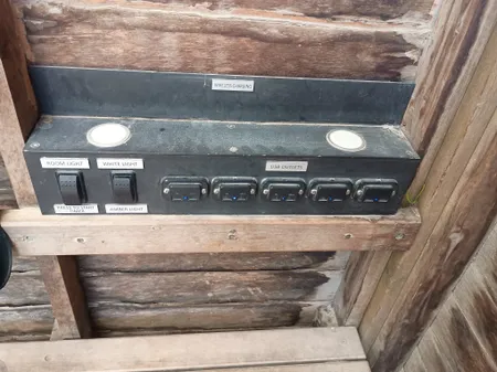
The shelter at Cape Otway was set up with solar power there was a bank we could charge your USB devices. This was quite a nice surprise. It was quite windy that night and the ground was soft and sandy so we had to take extra care to make sure the tent pegs were fully in the ground and able to take the strain. Overnight was quite nice, albeit a little bit windy.
We had breakfast then packed up and made our way back to the lighthouse. Taxi driver had organised some discount tickets for us so we took them up.
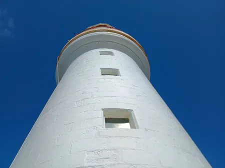
Cape Otway Lighthouse, a symbol of hope and safety for early immigrants, stands as the oldest surviving lighthouse on mainland Australia. Built in 1848, it was a direct response to the incredibly dangerous "Shipwreck Coast" and the treacherous western entrance to Bass Strait. For thousands of people sailing to a new life in Australia, this light was often their first glimpse of land after a harrowing sea journey that could last months. It quickly became known as the "Beacon of Hope," signalling the end of a perilous voyage and the start of a new life.
The decision to build the lighthouse was a tragic but necessary one. In 1845, the devastating shipwreck of the Cataraqui killed over 400 people, prompting the government to take urgent action to make these waters safer. Building the lighthouse was a true feat of engineering for its time; the sandstone was quarried five kilometres away and transported by bullock carts to the remote and difficult-to-access site. Even the massive lantern and light mechanism were shipped all the way from England.
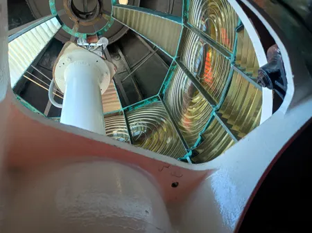
The lighthouse served its vital purpose continuously from its first lighting in 1848 until it was officially decommissioned in 1994. Although it was replaced by a modern, solar-powered beacon, the original tower remains a historical landmark and a powerful testament to Australia's maritime past. The site also includes other fascinating historical remnants, like a historic telegraph station and a World War II radar bunker, each with its own story to tell about the Cape's strategic importance through the years.
We stopped off at the cafe which did a nice round of jam and cream scones. It would have been rude not to.
Taxi arrived and we were on our way back to Apollo Bay.
Reflections
The walk from Apollo Bay to Cape Otway was a fantastic experience, showcasing the stunning natural beauty of the Australian coastline. The combination of challenging terrain, breathtaking views, and rich history made it a memorable adventure.
Water availability was a key consideration throughout the hike. While the campsites provided water tanks, the quality varied, and it was essential to carry a reliable water filter. The brownish tint of the water, caused by tannins from leaves, was a common feature but did not affect its safety for drinking. There were a few streams which could be used as additional water sources, but their flow was seasonal, so planning ahead was crucial. We walked in Spring when there had been a lot of rain so the streams were flowing well. Summer would be a different story.
The campsites were well-maintained, with basic amenities like toilets and shelters. They must be booked. However, they could get quite busy during peak seasons, so booking ahead was advisable.
Getting There
Apollo Bay is accessible by car via the Great Ocean Road, which offers a scenic drive along the coast. For those relying on public transport, V/Line operates bus services connecting Apollo Bay to Geelong or Warrnambool. The Warrnambool service only 3 times a week so check the timetable.
There are various tour operators offering services. We used Alan from Go Go Walking Tours. He was prompt, friendly, and knowledgeable about the area. 0400 404 0460