Hotham To Harrietville Via Bon Accord Spur
Published:
Walking in the Victorian Alps is a great way to experience the beauty of the region. The walk from Hotham to Harrietville via Bon Accord Spur offers a unique opportunity to explore the alpine environment while enjoying the challenge of hiking.
Day 1
We took the train to Wangaratta, passing Docklands, Footscray, Sunshine, and Broadmeadows. The weather changed from cool and cloudy to sunny as we crossed the great divide. After several hours, we arrived in Wangaratta, where it was 38 degrees. We settled into our accommodation and took a rest before exploring a walking track along the Ovens River.
Returning to the motel, we decided on dinner and chose a Mexican place, enjoying delicious burritos.
Day 2
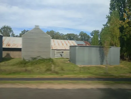
The next morning, we made our way to the train station and caught the bus to Bright. It's a very nice area full stop it seems to have set itself up as some kind of foodie hub or stop passing through Myrtleford you can see old tobacco drying sheds. These were from back when tobacco was an important crop in the area.
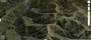
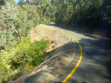
We stopped off at Bright for a couple of hours while we waited for our next connection. We found a shady spot down by the river to wait and enjoy lunch. The bus arrived and we got on. We moved through different country as we started going through the foothills of the alps. Once we got to Harrietville it was a serious climb up to Mount Hotham curving its way with tight curves around spurs. The bus stopped at the village where we got off and embarked on our walk.
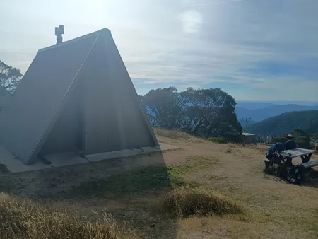
We made our way up to the summit of mount Hotham following a gentle slope which in winter times was a ski run for stop. From the top gets some very good views.
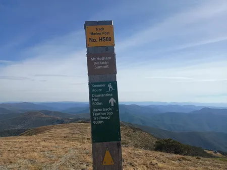
We made our way down the other side which was a bit steeper and a little harder going but after an hour or so we arrived at Diamantina Hut. We had the place to ourselves although another camper to turn up as we were preparing dinner. We chatted to him he was there to do the Run for stop there is an annual event where runners can choose from three different courses one 20km, another 40km and another run over 60km. Absolutely madness if you ask me.
The water situation at Diamantina Hut is seasonal. There supposed to be a spring near the old Murray Valley Ski Club hut across the road. We didn't find it. There was no sign of water. We went at the beginning of Autumn after a dry summer. There has been no decent rain for a month.
Day 3
My fellow walker reported feeling unwell the following morning. He thought he had picked up some kind of stomach bug. So we decided to change our plans. Instead of heading for Federation Hut along the Razorback, we would make our way down Bon Accord spur to Harrietville. The plan was to make our way down the spur and camp at Washington creek which is about five kilometres from town for stop that way we can pick up more water. As we were signing the trip intentions log a group of around 15 scouts were making their way to Federation Hut. There was an American couple doing the same thing. So, we thought Federation Hut would get quite full. 20 tents was definitely at capacity. That cemented our decision to head down Bon Accord spur.
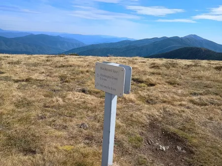
That sign is incorrect. Bon Accord spur is listed as a grade 4 walk. The signed distance was around 13km. It drops around 1200m in that distance. The walk down was quite steep and rocky which made it slow going. Parts of it felt like we were going inch by inch and the steepness was pushing my toes into the toe box of my shoes. Not a pleasant feeling.
There were quite a few runners coming down the spur so he had to check to make sure that we were not in their way. We met a group of hikers coming up the spur. I told them about the scout group. I suggested they check out the space where Diamantina spur meets Razorback as there is some good flat ground and that area although it does make it a bit further to get to water.
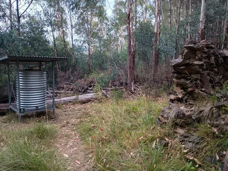
We kept going but it was quite steep. Eventually, it levelled out and we came across the ruins of the old Bon Accord Hut. All that remains is the old fireplace. The hut was built in 1930 and was used as a base on the way up to the ski fields. It was destroyed by fire in 2003. The area is now a popular camping spot for hikers and skiers. One thing that was quite nice to see was a newly installed water tank with some water in it. We were not expecting that so that was a very welcome surprise. We filled up water bottles and decided to rest there the night.
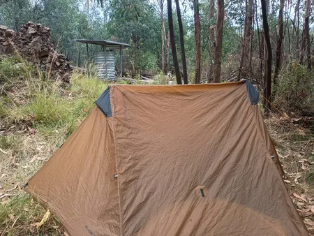
It's a very small camp area with only enough space for two or three tents. We decided to rehydrate and spend the night there. The only downside to the area where the persistent European wasps. The wasps kept us on the move especially when we had food. Somehow I managed to get a sting on the bottom of my toe which was a bit annoying.
Day 4
We woke to a cloudy day. We checked the weather. There was a rain band due to hit around the middle of the afternoon. Given the slow progress on the day before, we knew we wouldn't make it to Harrietville before the rain. The plan was do we make it down to the Washington Creek campsite and make it decision there whether or not to carry on.
Coffee and breakfast. We packed up and got on our way. We were definitely within the tree line. The track was a lot easier and we made better progress.
We got down to Washington creek mid-afternoon. There was absolutely no find signal so not a chance of any data. Looking at the sky, it looks like the rain wasn't too far away. We guessed we had an hour or so before the rain band would get here. So we set up our shelter. The ground was quite rocky so it made getting the tent pegs in a bit tricky. It's a small area with space for several camping spots.
The rain came. We retreated into our shelter and watched the rain pour down. There was a river running off my tarp.
The rain lasted for around 3 hours. The creek had risen up quite a bit but not a flood risk.
Once cleared, we cooked dinner, the sun set and time for bed.
Day 5
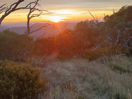
The morning was clear. We had breakfast. Packed up and headed up the hill.
It was a relatively short work Lasting only a couple of hours where we followed the Ovens River down to Harrietville.
Pioneer park was a welcome sight. The weather was superb. We sat down and relaxed and waited for the bus. Checked out the local cafe came back with coffee and toasted bagels for lunch. The cafe was quite busy with lots of tourists stopping off along the way and people riding the bike trail from Bright. Something to check in a future adventure perhaps.
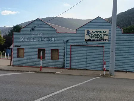
The bus arrived and we were on our way to Omeo.
Getting There
Car: You can drive to Harrietville from Melbourne. It's about a 4 hour drive. The road is sealed all the way to Harrietville. That would mean climbing up either Bungalow spur or Bon Accord spur. Bungalow spur is a the more popular route. Bon Accord spur is a bit steeper and a bit more challenging.
Another option to avoid a car shuffle is park at Harrietville and take the bus to Hotham. The bus may stop at Diamantina Hut if you ask the driver nicely. The bus service is run by Alps Link Bus and runs towards Hotham at 1:45pm (Mon, Wed & Fri). It arrives at Hotham at 2:30pm. You may run out of daylight along the Razorback, so probably best to stay at Diamantina hut and set out the next morning.
Bus: The bus service is run by Alps Link Bus and runs towards Hotham in the early afternoon (Mon, Wed & Fri). You could start from Omeo. The leaves Omeo at 8:30am and arrives at Hotham around 10:30am. Check the timetable for the latest information. The bus service is run by Dysons.
Alps Link Bus: Runs between Bright and Omeo on Monday, Wednesday and Friday. Coming from Bright, it leaves at 1:45pm and arrives at Hotham at 2:30pm. You can also catch it from Omeo at 8:30am. It arrives at Hotham at 10:30am. This option will give you more daylight.
The bus service is run by Dysons. Check the timetable for the latest information.
Vline: Operates services to Bright from Wangaratta twice daily. There are services to Bairnsdale from Melbourne. Vline timetables
PTV: The number 14 bus runs between Omeo and Bairnsdale Monday to Friday. It leaves Bairnsdale (Monday to Thursday) at 1:25pm and arrives at Omeo at 4:00pm. On Friday, it leaves Bairnsdale at 3:40pm and arrives at Omeo at 6:15pm. https://www.ptv.vic.gov.au/route/timetable/1440/14-bairnsdale-omeo/
Links
Razorback Run https://www.runningwild.net.au/alpine-runs/razorback-run.html